

Free Ads Submit
View Free Ads

UK Weather Forecasts
One of the most vital elements of your sailing pleasure is the weather, it can
make or break your race, and those with the best understanding of climatic
changes will benefit the most when the inevitable changes occur.
One thing that we can all be certain of is the fact that the wind will not
remain constant in direction or strength for long, and every change is an
opportunity to either pass or pull away from the opporsition.
I am by no means an expert in forecasting or understanding the weather, but I am certain that all sailors, either for reasons of safety or performance, must do everything possible to understand this complex subject.
Below are some links to weather forecasts, and satellite pictures, both should help predict the conditions to expect when on the water. In addition I have included some information on weather patterns and cloud formations, which can help your understanding of the likely changes to expect over a period of time. While on the racecourse an understanding of cloud formations will give an indication of the likely change in strength and direction that is about to happen. This will indicate which side of the racecourse will benefit most from the changes.
The diagrams below are quite large, so depending on your screen resolution you may need to scroll across. If you would like a copy of these and other diagrams then you can download them here., available as public domain software from M&M Software
Firstly look at the different types of cloud formations and learn to identify
them, they will help you understand what is happening and what to expect.

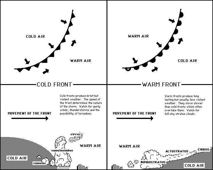
Now lets look at how these clouds are distributed in Cold and Warm fronts, quite often you can see a front approaching, and hence identify the wind direction and strength changes that will occur.
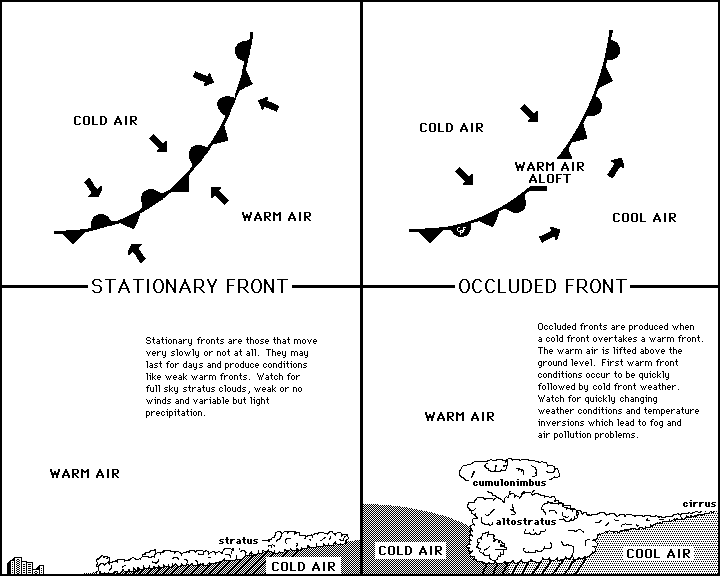
You can of course have Stationary of Occluded fronts, each with their own distinct characteristics.
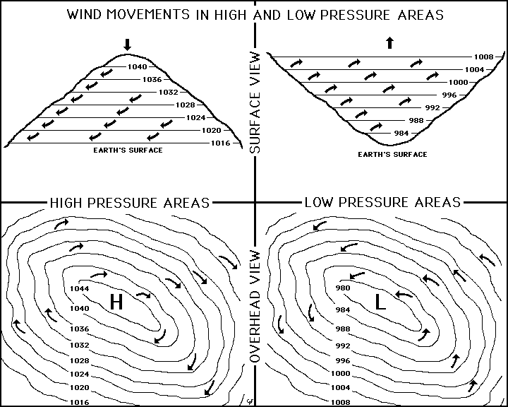
Finally remember that in the northern hemisphere the wind will always circulate clockwise in a high pressure zone, and anticlockwise in a low.
Send e-mail to [email protected]
Copyright © 1998 - 2021
UK Dinghy Racing
Designed By:Xpert Web Builder